
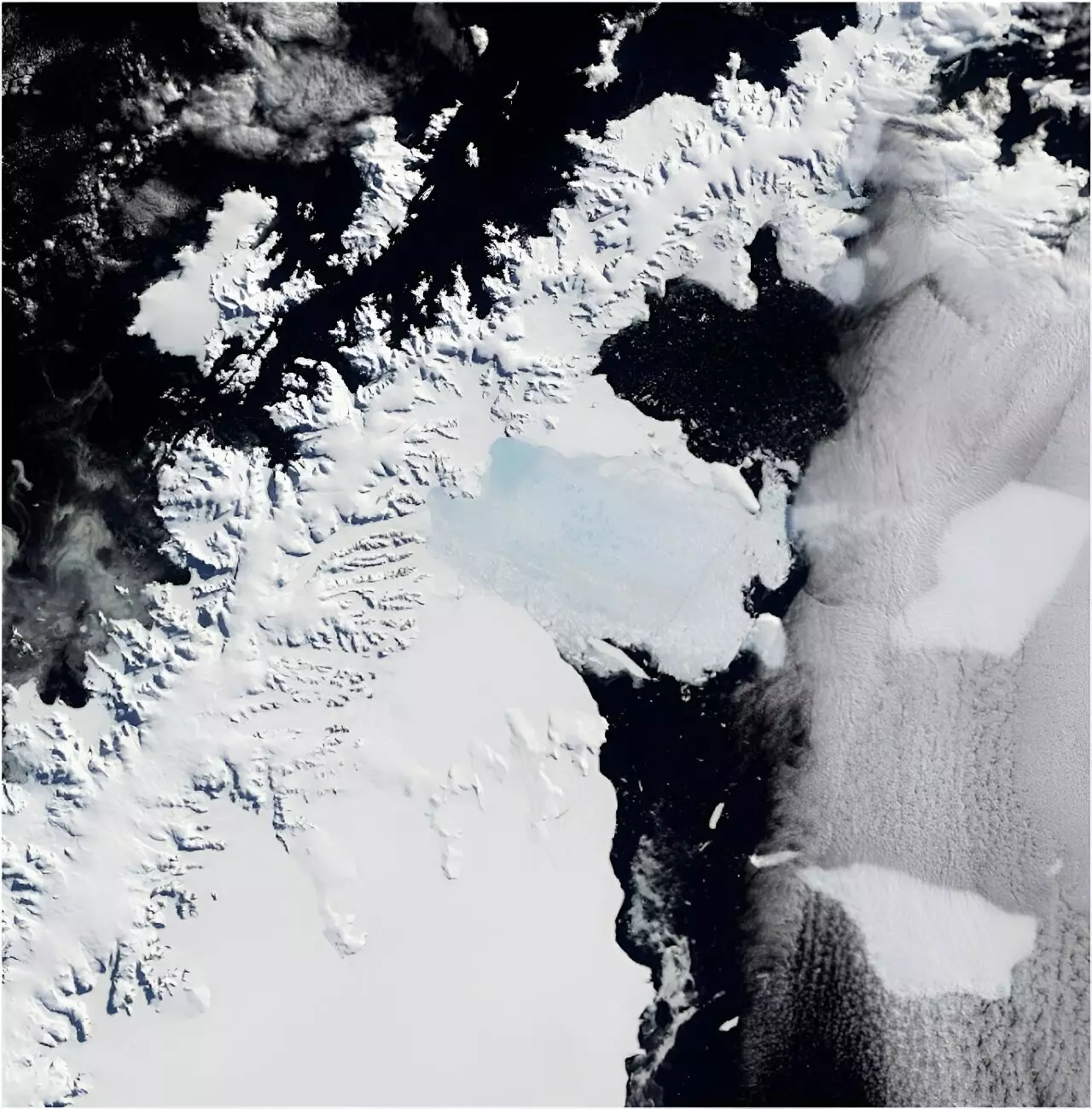
In March 2002, the world witnessed a significant environmental event: the catastrophic collapse of the Larsen B Ice Shelf. This event unfolded dramatically over the course of just one week, resulting in the disintegration of an area roughly one-sixth the size of Tasmania. Such a colossal calving not only reshaped the Antarctic landscape but also set off alarm bells regarding global sea levels. The implications of the thawing ice are far-reaching and complex, particularly concerning the rapid melting of glaciers that were once restrained by this floating ice barrier.
One critical aspect of climate change is the interconnectedness of earth’s systems. Antarctica, often perceived as a remote and distant land, plays a pivotal role in the global climate and sea-level dynamics. As conditions on this icy continent change, they expose coastal populations worldwide to the impacts of rising sea levels—a phenomenon we can neither ignore nor overlook.
Decoding the Past: The Power of Photographic Records
A recent study published in *Scientific Reports* dives into the past to bring clarity to the present state of five glaciers formerly connected to the Larsen B Ice Shelf. By utilizing an archive of nearly 1,000 film photographs captured in the 1960s, researchers could reconstruct detailed historical models of these glaciers. The study serves as a critical reminder that sometimes our most powerful tools for understanding climate change do not come from the latest technology, but from well-preserved historical records.
The significance of this archival research cannot be understated. With rudimentary imaging technology from decades ago, scientists now have the ability to analyze detailed changes in the glaciers, providing insights that satellite images alone cannot deliver due to frequent cloud cover hindering observations in Antarctica. This juxtaposition of historical photographs against modern observations highlights the importance of comprehensive data—showcasing how changes over time can reveal alarming trends.
Glacial Retreat and Its Insidious Impact
The study illustrates the drastic consequences that arise once ice shelves collapse. Following the disintegration of the Larsen B Ice Shelf, the five glaciers studied collectively lost a staggering 35 billion tons of ice. To put this number into perspective, it’s comparable to every person on Earth pouring out a liter of water daily for ten years—an astonishing figure that underscores how singular events can compound into global crises.
While the immediate effect of ice loss might appear insignificant on paper—only contributing about 0.1 mm to global sea levels—it serves as an alarming indicator of larger patterns at play. The Larsen B Ice Shelf event exemplifies the cascade of consequences resulting from climate change. The rapid melting of glaciers accelerates the transfer of ice from the land into the ocean, suggesting that what seems like a minor fluctuation could have lasting impacts on the world’s oceans and the ecosystems that rely on stable sea levels.
Innovative Technologies in Climate Research
Modern climate science continues to evolve, utilizing advanced techniques such as photogrammetry to create accurate 3D models of glaciers. Unlike traditional methods that rely on a couple of overlapping images, today’s technology combines hundreds of photographs to generate detailed, scalable models. This progressive technique allows for an unparalleled portrayal of glacier dynamics in real-time, bridging the gap between past and present access to these remote terrains.
Moreover, the repository of 330,000 historical images amassed by United States Navy cartographers provides a crucial baseline for scientific inquiry. These images, safeguarded and digitized by the Polar Geospatial Center at the University of Minnesota, can now serve as a benchmark for change, establishing what once was and how it has transformed. This is not just a record of the past; it is a roadmap for future research that can guide us in our understanding of environmental dynamics as they adapt to warming climates.
The Future of Climate Research: A Treasure Trove of Possibilities
As climate change accelerates, the significance of historical photographic archives becomes even more pronounced. Beyond analyzing glacial shifts, these images offer a gateway to explore a multitude of topics, including shifts in coastline topology, variations in local flora and fauna, and the impact of human activity on pristine environments. They have the potential to offer insights into the entirety of the continent’s ecological and geological evolution over decades.
In a world that increasingly seeks to understand and address the nuances of climate change, we must recognize the wealth of knowledge contained in historical images and records. The research indicates that the knowledge gleaned from past conditions can illuminate what lies ahead. Each photograph is not just a visual representation of ice and rock; it acts as a prescient warning of the uncertain futures awaiting our planet if we fail to act responsibly and urgently.
Leave a Reply