Positioning technology in urban environments has long been constrained by various extenuating factors, particularly signal blockages due to tall structures and potential interference from urban infrastructure. Such conditions are particularly problematic for Global Navigation Satellite System (GNSS)-based Real-Time Kinematic (RTK) systems, which are essential for applications requiring pinpoint accuracy. Traditional solutions, which have often relied on older technologies such as Wi-Fi and Bluetooth, have struggled to overcome these challenges effectively. With the rapid expansion of 5G network infrastructure, there is an opportunity to leverage its advanced capabilities to substantially improve the performance of positioning systems in cities.
The Breakthrough: 5G-Assisted BeiDou System
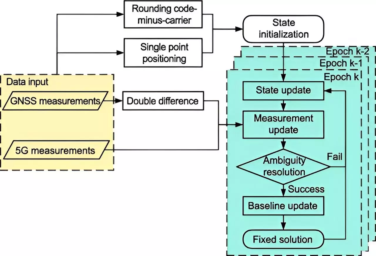
Researchers from Tsinghua University have taken a significant step forward in addressing these urban obstacles by developing a 5G-assisted BeiDou Navigation Satellite System (BDS) RTK positioning framework, a groundbreaking venture highlighted in their recent publication in Satellite Navigation. This system harnesses the synergy between 5G technology and BDS to enhance positioning accuracy significantly. By employing sophisticated techniques such as an extended Kalman filter and advanced ambiguity resolution methods, this innovative system optimally fuses 5G data with traditional satellite signals.
The results from this pioneering research indicate noteworthy enhancements in positioning accuracy within urban landscapes. By utilizing gain factors to assess performance metrics such as the float solution and ambiguity dilution of precision (ADOP), the 5G-enhanced system demonstrated a substantial reduction in positioning errors. Specifically, spatial errors were diminished by an impressive 48% in full ambiguity resolution (FAR) mode, and by 18.8% in partial ambiguity resolution (PAR) mode. Additionally, fixing rates—critical for establishing reliable positioning—showed considerable improvement; they surged from 11.11% to 13.93% in FAR mode and from 32.58% to 44.43% in PAR mode.
Broader Implications for Urban Technologies
These findings underscore the profound potential of integrating 5G technology with BDS RTK systems for various real-world applications, ranging from autonomous vehicles to public safety enhancements and smart city initiatives. Dr. Tengfei Wang of Tsinghua University noted that this integration addresses several longstanding challenges faced in urban settings, improving signal quality while augmenting the visibility of satellites. As urban landscapes evolve, the need for robust and reliable navigation solutions is paramount, and this novel approach could transform the future of urban positioning.
As 5G networks continue to proliferate, the utility of the 5G-assisted BDS RTK system could extend its applicability beyond city centers, potentially offering enhanced location-based services in varied environments. Future research efforts are set to explore the performance of this innovative system in diverse real-world scenarios, aiming to further refine the technology for even greater accuracy and reliability. The integration of advanced technology like 5G with traditional positioning systems marks an exciting development in the quest for high-precision navigation, providing a pathway toward smarter, more navigable urban environments.


Leave a Reply